The Conservation Fund and Northwest Arkansas Land Trust have announced the purchase of a key Civil War battle site in Benton County. The Northwest Arkansas Land Trust, with assistance from The Conservation Fund, recently acquired the historic 140-acre Williams Hollow Farm and intends to donate the property to the National Park Service once funding is secured.
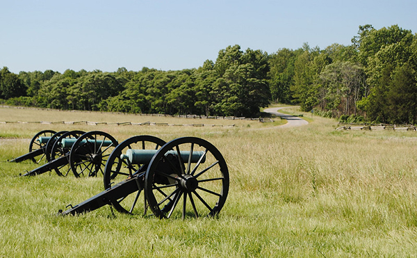
Bordered on three sides by the Pea Ridge National Military Park, the property has been a conservation priority for the National Park Service since the national park’s designation during the Civil War Centennial of 1963 and is crucial to the preservation of the historic Civil War battlefield. In March 1862, U.S. Brigadier General Samuel R. Curtis’s 10,500 troops in the Union Army of the Southwest clashed for three days with commander of the Confederate Army of the West, Major General Earl Van Dorn’s 13,000 troops. The battle ended in Union victory and prevented the Confederates from advancing into and enabling the secession of Missouri. The Williams Hollow Farm was an integral site used before, during and after the battle.
“Northwest Arkansas Land Trust is excited to partner on the permanent protection of Williams Hollow Farm,” said Marson Nance, Land Trust director of land protection and stewardship. “For over 16 years Northwest Arkansas Land Trust has worked tirelessly to protect open spaces throughout the region for protection of natural resources and our cultural and historic heritage. The Williams Hollow acquisition is a perfect example of collaboration between national, regional, and local partners working to protect sites of great ecological and historical importance. Northwest Arkansas Land Trust is proud to be a part of this effort.”
“We’re excited to continue working with our partners to protect this important battlefield. Williams Hollow Farm is important to the park as it helps tell the story of the battle that took place 158 years ago,” said Kevin Eads, superintendent of Pea Ridge National Military Park and board member of Heritage Trail Partners. “Its preservation will help to protect cultural and natural resources.”
Once protected, the Williams Hollow Farm will secure the viewshed of the Pea Ridge National Military Park and conserve mature forest habitat for migratory songbirds and rare bats, including The threatened northern long-eared bat. Keeping the property undeveloped will also help provide water quality protection of Sugar Creek within the Elk River watershed. “The Conservation Fund has a long history of preserving critical Civil War sites throughout the United States, and we are proud to advance this effort to conserve the Williams Hollow Farm,” said Clint Miller Midwest project director for The Conservation Fund. “The significance of this property is truly unique and multi-faceted, from protecting a key part of the battle to providing important habitat for rare species and preserving the memory of other historic events, including the Trail of Tears.”
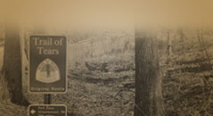
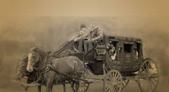
The Williams Hollow Farm played a significant role in pre-Civil War history as well. Passing by the property to the northeast is Telegraph Road, a historic transportation route through northwest Arkansas that takes its name from the first telegraph lines in the area. Beginning in the 1830s, Telegraph Road was used as a route on the Trail of Tears, the forcible relocation of the Cherokee people and other Native Americans to Oklahoma in the winter of 1838-39 after the enactment of the Indian Removal Act of 1830. The historic road was also part of the Overland Mail Company route, a transcontinental mail system that also offered stagecoach transportation to settlers, miners and businessmen traveling between St. Louis, Missouri, and San Francisco from 1857 to 1861.
The permanent protection and transfer of the Williams Hollow Farm to the National Park Service will depend on fundraising. Various organizations have stepped forward already to assist, including the Pea Ridge National Military Park Foundation and National Park Foundation.
“It is a rare opportunity that we have the chance to preserve our past for future generations in a setting such as this,” said Pea Ridge mayor Jackie Crabtree, who is also chair of the Pea Ridge National Military Park Foundation and vice-president of Heritage Trail Partners. “While the acquisition of this historic property is exciting, it is critical that we raise the funds to permanently make the Williams Hollow Farm part of the Pea Ridge National Military Park. Time is of the essence, and we need our community to step up and bring this project home.”
In addition, the property will be conserved, in part, by funding and technical assistance in partnership with U.S. Fish and Wildlife Service (USFWS) made available through mitigation efforts by Plains All American Pipeline in conjunction with ongoing construction and maintenance of the Diamond Pipeline, a crude oil pipeline that currently extends from Cushing, Okla. to Memphis. The Conservation Fund serves as the administrator of the funding source and works collectively with Plains and USFWS to achieve mitigation solutions with the highest conservation value.
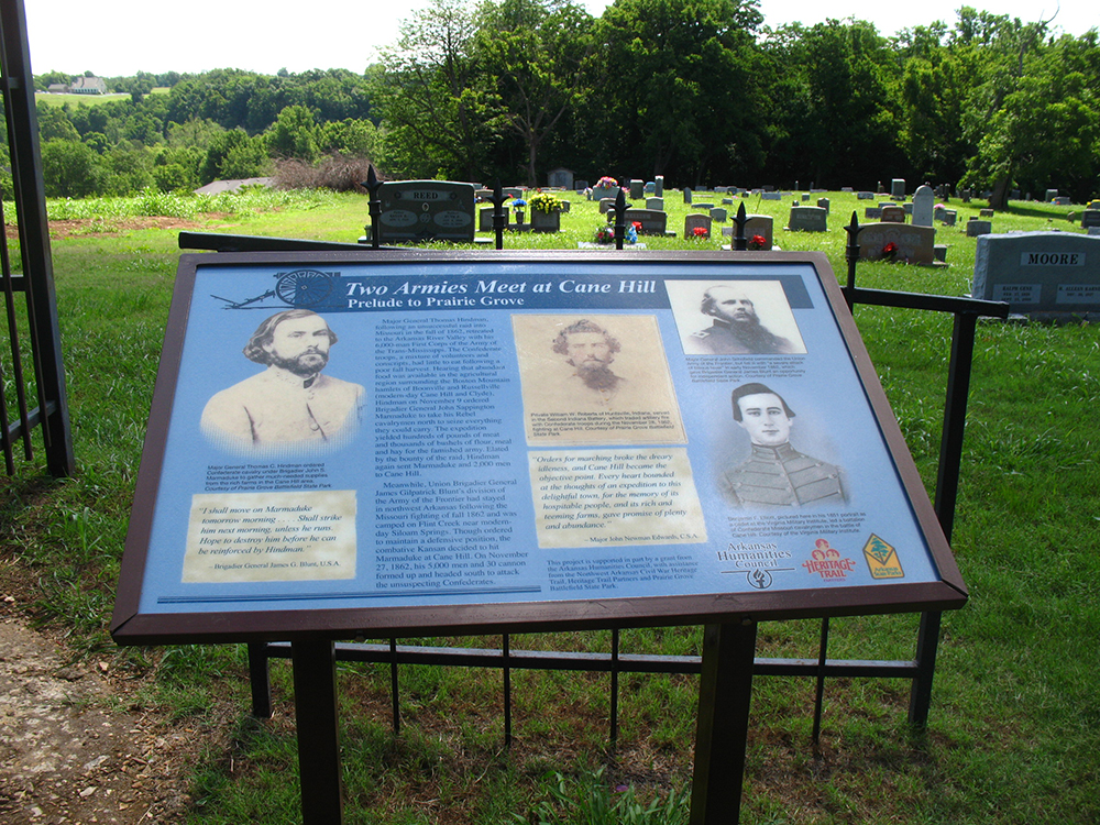
Settled by Anglo pioneers in 1827, Cane Hill is one of the earliest settlements in Washington County. The community was a witness to both Trail of Tears and Civil War activities. The Cannon detachment of Cherokees passed through here in 1837 on their forced removal to Indian Territory. Still standing and currently undergoing restoration is the Methodist manse. Built in 1834, the building is under review for inclusion as a “witness structure” on the Trail of Tears National Historic Trail.
Cane Hill was also the site of a Civil War skirmish in 1862.
Located in southwest Fayetteville, the area historically known as Cato Springs is named for the John Henry and Jacob Cato, brothers who homesteaded here in 1849. Three large springs made the location a favorite camping spot for troops during the Civil War. Cato Springs was also the scene of many Confederate reunions after the war. A marker honoring Co. K, Arkansas Infantry, CSA, can be found on Cato Springs Road about three miles south of Fayetteville. Commanded by Capt. T. J. Kelly of Cato Springs, Co. K was the first Confederate company organized in Fayetteville. The markerl was erected by local chapters of the United Daughters of the Confederacy.
The western Washington County community of Dutch Mills was originally called Hermannsburg. It was founded by German immigrants led by brothers Johann and Karl Hermann, who came to the area from St. Louis, Missouri, in 1852. The German settlers established a flour mill, lumber mill, and woolen mill, and carried on a profitable trade with customers from nearby Indian Territory. The Civil War, however, spelled ruin for Hermannsburg. The settlement was situated on a route used by both armies as well as bushwhackers, putting the residents of Hermannsburg in constant danger. Pro-Union in their sympathies, the German families fled to Missouri after the Battle of Prairie Grove in December 1862.
Hermannsburg was renamed Dutch Mills after the Civil War.
Land entries reveal that Anglo settlers were living in the Elm Springs vicinity of Washington County by 1831. There are a number of springs and creeks in the area; such a plentiful water supply led John Ingram to build a water mill here in 1844, the first of several milling operations to be located here. During the Civil War, both Union and Confederate forces sought control of the mills at Elm Springs. The numerous springs also made the area a good campground for troops. General Earl Van Dorn’s Confederate army gathered here before the Battle of Pea Ridge in March 1862.
The pioneer settlement of Evansville (in western Washington County) was named for Capt. Lewis Evans, a local storekeeper, miller, postmaster, and the first county sheriff.
In 1827, John Conner and several families left Illinois bound for Arkansas. When they reached present-day Evansville, they found several Anglo families living there. At that time, the region was officially Cherokee land. Soldiers from Fort Gibson in Indian Territory (present-day Oklahoma) were sent to evict the white squatters, but many of them ignored the order to leave. The Treaty of 1828 removed the Cherokees to what is now northeastern Oklahoma, legally opening this section of Washington County for settlement. Evansville soon became a center of trade.
Both the Benge and Bell routes of the Trail of Tears passed through Evansville. A Trail of Tears interpretive marker is located at the intersection of Arkansas highways 156 and 59
Early in the Civil War, Evansville was occupied by Gen. Stand Watie’s Cherokee Confederate troops.
Fayetteville’s beautiful Evergreen Cemetery contains the graves of hundreds of people who left their mark on Washington County and Arkansas history. Established in the 1840s as the Thomas-Pulliam family burying ground, Evergreen was deeded in 1871 to the city by the Masonic and Odd Fellows lodges.
Among those buried at Evergreen whose stories intertwine with the Heritage Trail:
Sophia Sawyer, who served as tutor to the children of Cherokee chief John Ridge and Sarah Ridge. She also established the Fayetteville Female Seminary in 1839 as a school for Cherokee girls.
Thomas Gunter, a colonel in the Thirteenth Regiment, Arkansas Volunteers (Confederate).
Former slave Adeline Blakeley (1850–1945), perhaps the only African American burial in the cemetery
Lafayette Gregg, a colonel in the Fourth Regiment, Arkansas Federal Cavalry Volunteers
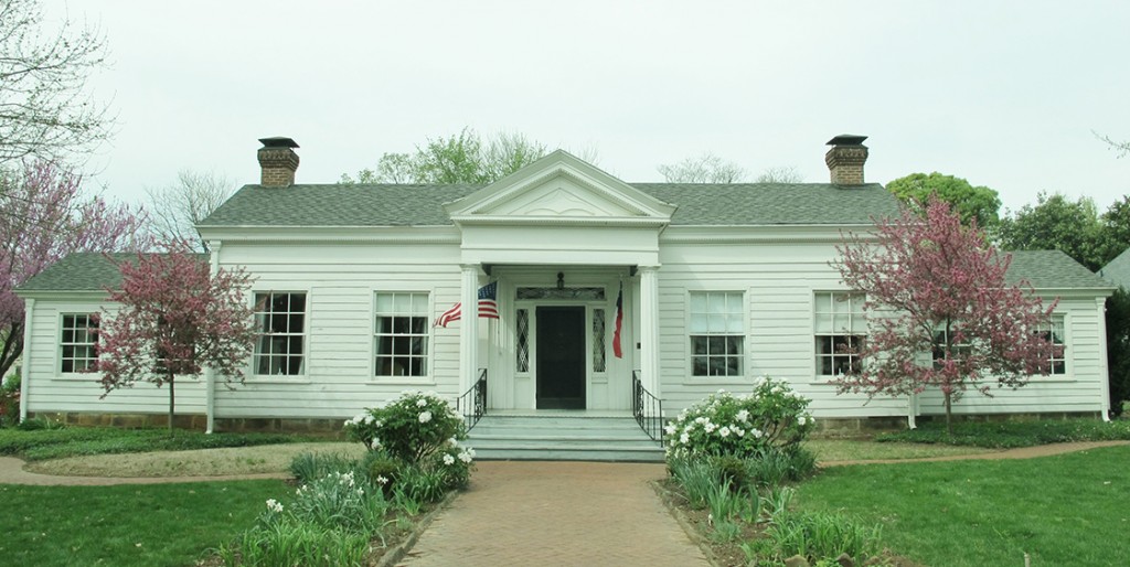
Built in Fayetteville in 1853 by Jonas and Matilda Tebbetts, Headquarters House is one of the finest examples of Greek Revival architecture in Arkansas. The house is just a few blocks north of the Butterfield Overland Mail’s Fayetteville Station, which was located at the present-day site of the historic Washington County Courthouse. During the Civil War, the Tebbetts home served as headquarters for both Union and Confederate troops, hence the name “Headquarters House.”
Today the property is owned by the Washington County Historical Society. Headquarters House was added to the National Register of Historic Places in 1971. The Archibald Yell Law Office was moved to the Headquarters House campus in 1992. Heritage gardens featuring heirloom plants make the grounds a lovely place for a stroll.
The Mount Comfort community, now part of northwest Fayetteville, was settled about 1830. One of the first settlers at Mount Comfort was William Cunningham. He built a fine brick home, perhaps the first brick house in Washington County, on his farm about one mile northeast of the present-day Mount Comfort Cemetery. At least two Cherokee detachments on the Trail of Tears passed by the Cunningham home on their journey to Indian Territory. Records kept by the B. B. Cannon detachment note that on December 25, 1837, the group “halted a half mile in advance of Mr. Cunningham’s at a branch, 3 o’c P.M.”Dr. William Morrow, physician assigned to the Richard Taylor detachment wrote that on March 21, 1839, he“passed through Fayetteville and met detachment at Cunningham’s, 3 miles from town.”
During the Civil War, Mount Comfort was the location of Confederate recruiting posts and a Unionist farm colony. The Mount Comfort Church was used as a hospital during the war.
Text of the Arkansas Sesquicentennial Commission’s marker at Mount Comfort:
After the August 10, 1861, Battle of Wilson’s Creek, Mo., four of Washington County’s first Confederate war dead—Sgt. S. R. Bell, Sgt. Wm. Brown, Pvt. Henry Fulbright, and Pvt. Samuel McCurdy—were buried in Mount Comfort Cemetery. The 34th Arkansas Infantry (CS) raised troops at Mount Comfort in 1862 and would fight at Prairie Grove and Jenkins’ Ferry. The community held hospitals for Union and Confederate troops and hosted a Unionist colony late in the war, where local farmers banded together for mutual protection from bands of marauders infesting the area.
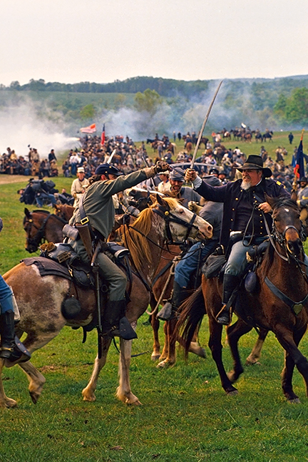
The campaign that would culminate in the Battle of Pea Ridge began December 25, 1861, with the appointment of Brigadier General Samuel R. Curtis to command the Union Army of the Southwest. Curtis’s mission was to destroy, or drive from Missouri his main opponent, Major General Sterling Price and about 8,000 troops of the Missouri State Guard, then wintering in Springfield. Hoping to catch Price when he was most vulnerable, Curtis launched his 10,500 troops during the bitter winter cold of early February, 1862. Outnumbered and ill-equipped, Price led his troops out of Springfield, south along Telegraph Road into Confederate held Arkansas, relentlessly pursued by the dogged and determined Federals. Skirmishes erupted daily as the two sides trudged south, often buffeted by freezing winds, rain, sleet, and snow. Reaching Cross Hollow Arkansas, Price united with a larger better supplied regular Confederate force commanded by Brigadier General Benjamin McCulloch. On February 17, the pursuing Federals slammed into McCulloch’s rear guard in the first Civil War battle in Arkansas, on James Dunagin’s farm near present-day Avoca. Bloodied, but not deterred, Curtis slowed his advance, allowing the now combined forces of Price and McCulloch to withdraw safely into the Boston Mountains near present day Hog Eye and Strickler. During their retreat, the Confederates burned their barracks at Cross Hollow and then ransacked the military supply depot in Fayetteville, burning several city blocks in the process, thus making Fayetteville the first American city burned during the Civil War.
With the unification of Price and McCulloch, Curtis lost the strategic initiative. Two-hundred miles from his primary supply base, and with the Confederates increasing in his front, Curtis deployed his army to cover the approaches and prevent the enemy from reentering Missouri, then he settled down to wait. By the first week in March, Curtis’s livestock was so weak from food shortages that he feared he might not be able to transport his artillery or ammunition wagons if the Confederates made a sudden movement. Providentially, Curtis ordered the fragmented parts of his army to assemble on the bluffs overlooking the north bank of Little Sugar Creek just north of modern day Avoca. Dirt, rock, and timber breastworks were constructed, further strengthening an already formidable position.
Meanwhile, Major General Earl Van Dorn was appointed to command all Confederate forces west of the Mississippi. Van Dorn assumed command of the newly christened Army of the West including all the troops under McCulloch and Price. Hoping to destroy Curtis’ army while it was still scattered, Van Dorn turned his army northward on March 4 during a late winter storm. Moving north to Fayetteville, and then up the Elm Springs Road, Van Dorn arrived at Bentonville the morning of March 6. There he encountered a small Union force of about 600 troops and cannon led by Brigadier General Franz Sigel. Sigel had been camped near modern-day Centerton, but had received orders from Curtis to consolidate forces along Little Sugar Creek. A running fight began as the rebels chased Sigel east out of Bentonville along modern day Highway 72, across I-49 near the Marriott and down into Little Sugar Creek valley. Sigel’s force rejoined Curtis late in the day, and the Confederate army bivouacked along Little Sugar Creek near Highway 94.
Hoping to draw Curtis out of his strong position, Van Dorn led his army on long, difficult night march along the Bentonville Detour toward the Telegraph Road, squarely on the undefended rear of the union army. But as the sun rose March 7, Van Dorn began to realize too late that rapid marching in bitterly cold wet weather, coupled with food shortages had seriously crippled his army. McCulloch’s troops had fallen behind, and were still eight miles to the rear. Undaunted, Van Dorn pushed ahead with Price and the Missouri State Guard to open the battle, at the same time ordering McCulloch to rejoin him by a shorter route following the now obscure Ford Road.
Responding to reports of enemy activity behind him, Curtis methodically began withdrawing troops from his earthworks to accept the rebel attack from the north. Union forces encountered McCulloch’s troops, including two regiments of Cherokee Indians, just north of the little hamlet of Leetown about noon. Fighting raged for at least three hours, including a savage and bitter struggle in a densely forested thicket known as Morgan’s Woods. The deaths of McCulloch and his second in command Brigadier General James McIntosh, coupled with the timely arrival of Union reinforcements decided the issue. Tired, discouraged, and beaten, the Confederates retreated in disorder.
Two miles to the east another fierce battle raged as Van Dorn and Price with about 5,000 Missouri State Guard troops collided with about 2,200 young men fresh from the farms and small towns of Iowa and Illinois. Van Dorn had successfully flanked the Union troops by reaching the Telegraph Road to the north of Curtis’s position along Little Sugar Creek. The outnumbered Federals gamely held their ground near a two-story hostelry known locally as Elkhorn Tavern. By nightfall, the Federals were forced back about ¾ of a mile where they spent a cold, wet, cheerless night in a muddy cornfield.
During the night, the survivors of the Leetown fight rejoined their respective armies for another day’s battle in the open fields south of Elkhorn Tavern. Determined to break the Confederate hold on his supply line, Curtis unleashed a massive and well-coordinated artillery bombardment, followed by a dramatic infantry assault reminiscent of Napoleonic grandeur. By early afternoon, the attacking Federals had recaptured all the ground they had lost the previous day and chased the last of the Confederate rear guard off the field. Earlier in the day, Van Dorn ordered the army to retreat after realizing that he had failed to order his supply train forward, and was unable to re-supply his artillery with much needed ammunition. Acknowledging the many errors in planning at all levels, one Confederate officer said “We have fought a battle and been whipped. Or rather we whipped ourselves.”
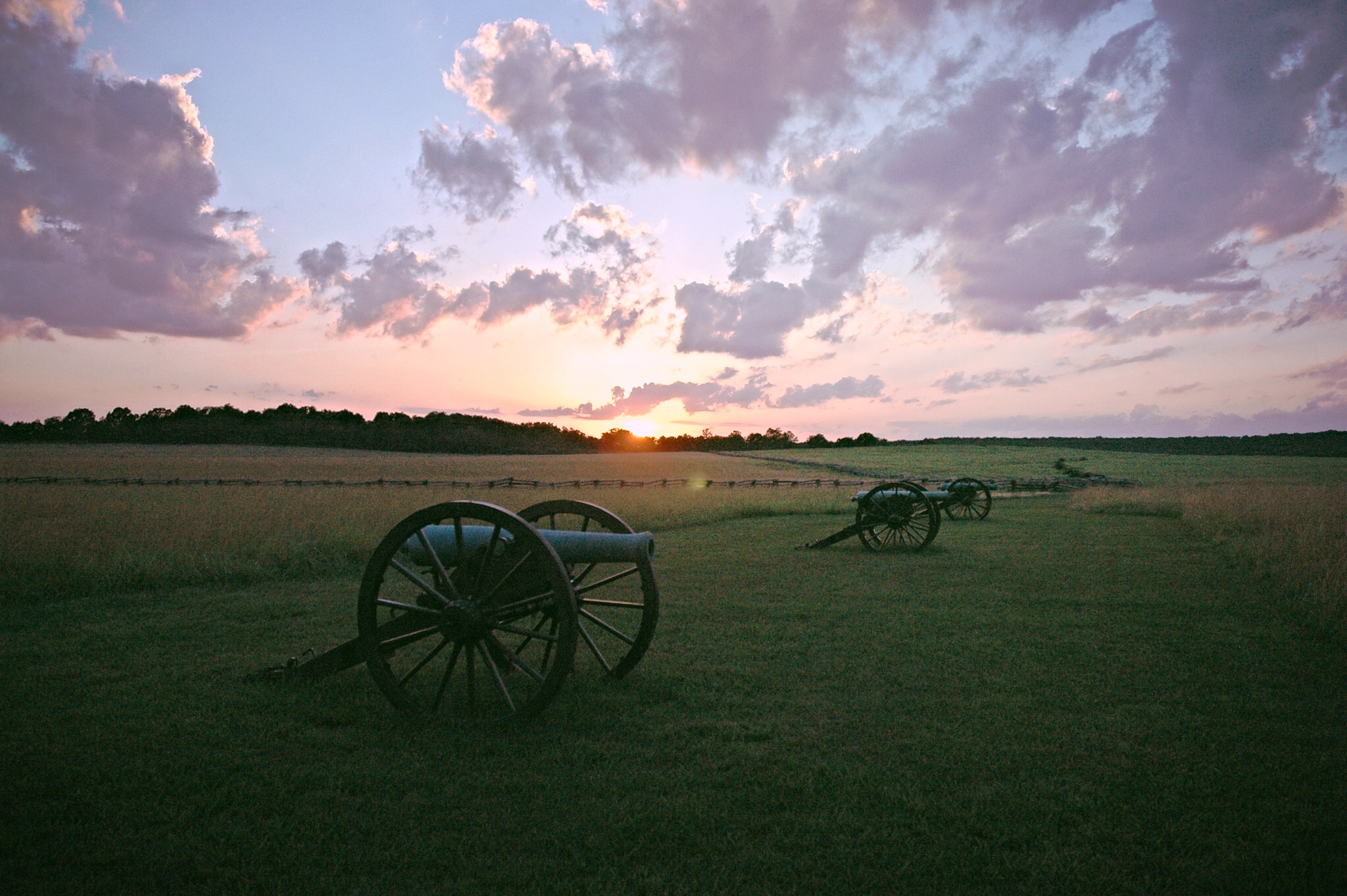
The Battle of Pea Ridge, often erroneously referred to as the largest battle west of the Mississippi, was in fact the most strategically decisive Civil War battle ever fought west of the great river. It crushed the best efforts of the Confederates to reestablish a presence in Missouri, guaranteeing that state’s political loyalty to the Union. From a military standpoint, it permanently shifted the balance of power in the region to the Union, making possible other larger campaigns for control of the strategic Mississippi River.


 Settled by Anglo pioneers in 1827, Cane Hill is one of the earliest settlements in Washington County. The community was a witness to both Trail of Tears and Civil War activities. The Cannon detachment of Cherokees passed through here in 1837 on their forced removal to Indian Territory. Still standing and currently undergoing restoration is the Methodist manse. Built in 1834, the building is under review for inclusion as a “witness structure” on the Trail of Tears National Historic Trail.